Geo Mapping

Visualize location data and locate your customers on interactive maps.

Pinpoint your target market on the map

img

Geo mapping is visual representation of geospatial data that analyzes data points on a map and provides insights and trends associated with specific locations. You can leverage this visual perspective to gain a profound understanding of the unique characteristics of each location.

With geo maps, you can adopt a targeted approach; whether your customers are distributed across a street, a neighbourhood, or even a city, geo mapping allows you to tailor your message effectively, ensuring it resonates with the right audience.

Eliminate guesswork and Uncomplicated decision making

Geo Maps visualises thousands of data points to identify focus areas. For retailers, geo maps pinpoint high-traffic areas, optimising retail site selection and product positioning. If you are a media owner or an advertiser, you can use geo maps for strategic campaign planning, monitoring, and overall management.

Geo maps simplify the process, whether you are shaping marketing strategies, optimising resource allocation, or planning to expand.

img
img

Target on a more granular level with precision

Whether you are in the retail business, financial sector, industrial, or even in the entertainment sector, using spatial data to micro segment your customers can help you design your marketing strategies to be more efficient.

With Meridian.API you can micro-segment your target audience and understand them better to enhance the effectiveness of your marketing operations.

Visualise your data as Heat Maps

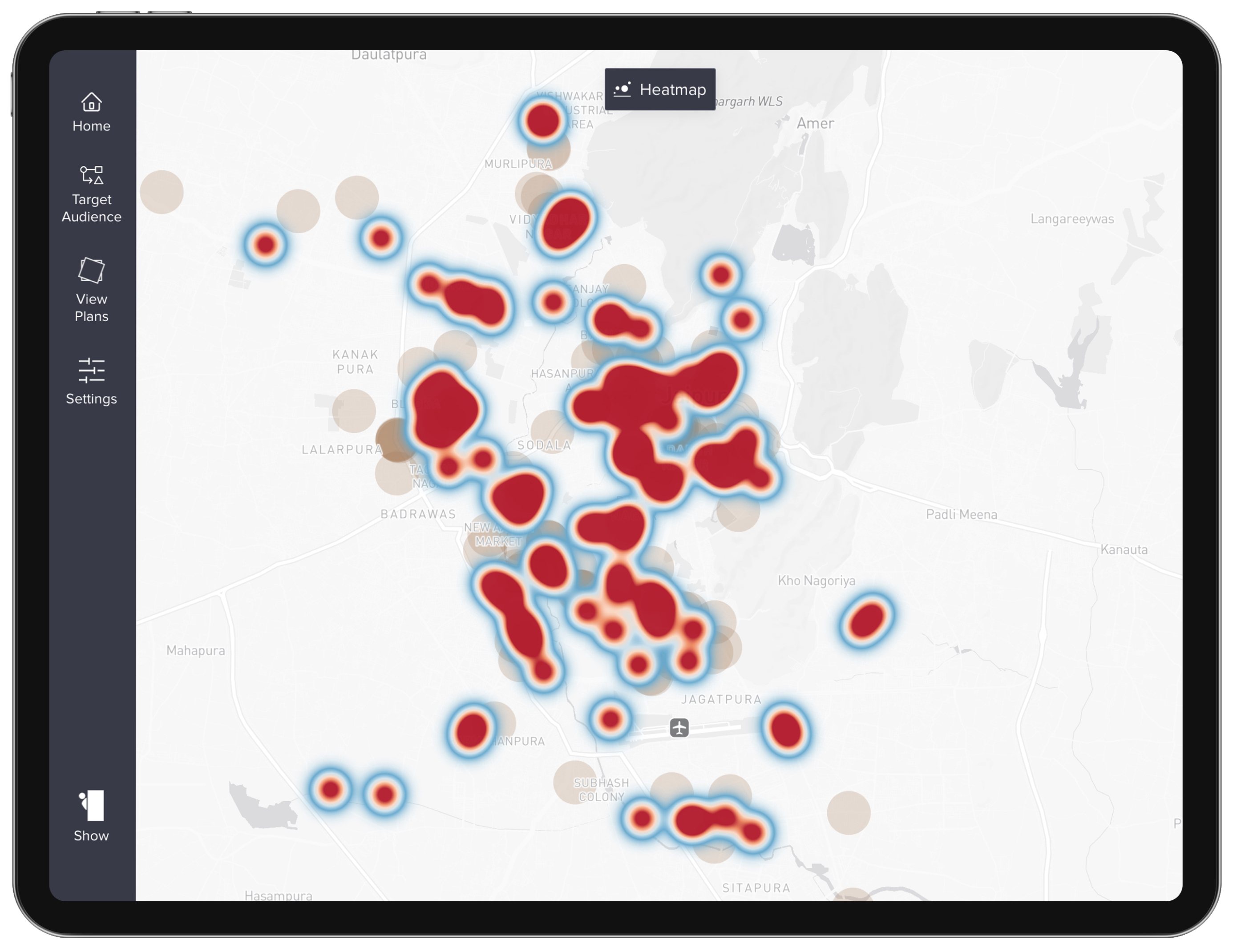
Geo maps turn raw data into actionable insights, presenting data as Heat Maps. This visual representation of a significant amount of data makes it easier to understand complex information.

img

Heat Maps

Heat maps visually represent data intensity on a map, using color gradients to highlight areas of higher or lower activity. Darker shades typically indicate higher intensity, offering a quick and intuitive way to identify patterns, trends, and concentrations within geographic data.

Writing

Visualize and validate complex data with Heatmaps

Contact Sales arrow_forward_ios

If You Can't Join Them, Beat Them!

The Meridian.API Newsletter

A newsletter about geospatial analytics, location intelligence, AI, data science, and data visualization. A newsletter also about building world class products and use of science, mathematics, and logical reasoning. A newsletter about sticking up to the man but also have fun doing business with him.

Personalized Services & Capacity Building

Build your own with our team of data scientists, statisticians, application developers and software engineers. Use geospatial data sets to augment sales, operations and gain deeper insights into your customer.

We actively work with our clients in setting up their own teams, digital ecosystem, and processes. We provide technical training, help with hiring and building in house data driven capabilities for the organizations we work with. You can leverage our expertise to build your own data-driven platform.

Kindly fill the form and we shall get back to you in flashiest of flashes.

If you’re eager to get in touch quickly, schedule a call with us.

Book an Appointmentchevron_right
|
+1
Obliged
Thank you for reaching out to us!

Your message has been successfully submitted. We will get back to you as soon as possible.

Something went wrong!

Please try submitting the form again. If the issue persists, please contact us directly at meridian@hashbrown.com.