Documentation

Welcome

Welcome to the Meridian.API documentation. Learn about solutions Meridian.API provides so you can plan and run a better campaign.

Speech

In this guide we will talk about everything you need to know to use our platform to the best of its abilities and introduce our suite of software and applications.

Introduction to the Meridian.API Platform

The Meridian.API platform is a complete solution for better advertising, branding, and marketing. The platform offers an array of tools and applications for capturing, viewing, editing, managing, analyzing, and sharing data within the framework of location. Access curated datasets and maps for deep insights into audience demographics and behavior. With Meridian.API, you can precisely target your audience, optimize campaigns, and plan media strategies for maximum impact and efficiency in your Ooh initiatives.

It helps you find your audience and build a better media plan.

What is Meridian.API?

Meridian.API is a location intelligence platform for advertising, branding, and asset management.

Meridian.API brings location data to life with heatmaps, lookalike audiences, socio demographic data, and streamlines the process of selecting prime advertising locations and retail branding opportunities with unprecedented accuracy to meticulously craft campaigns.

The set of tools and applications adds context to Out-of-home Media, the context for you to make better decisions with data. Users can access accurate performance metrics of each campaign location, such as reach, frequency, and impressions for each location.

Who Uses Meridian.API?

  • Advertising Agencies

    Advertising Agencies

  • Brands

    Brands

  • Media Owners

    Media Owners

  • Advertisers

    Advertisers

What makes Meridian.API unique?

Meridian.API makes location technology easy and convenient to use.

Meridian.API
  • Meridian.API is a complete set of tools and applications for planning, auditing, and ensuring compliance in out-of-home media campaigns.

  • Pricing algorithms help you price media on a higher point based on seasonality, occupancy, and audience behavior.

  • Determine your audience based on demographic factors like gender, income level, age group, and socioeconomic strata.

  • The planning tool makes it easy to understand complex data with its simple yet intuitive data visualization tool, heat maps.

Meridian Prime

Meridian Prime is a planning tool that connects you to millions of data points to build plans, run analysis of different locations, and apply AI and machine learning for better outcomes.

Create a Plan

  • Select a City

    City
  • Select the POIs

    POIs
  • Choose the Target Audience (User Personas)

    User Personas
  • View Traffic Metrics

    Metrics
  • Heatmap

    Heatmap

Here is a step-by-step guide to help you get started with the Meridian Prime app.

To build a plan, we will create a media plan for a Car accessories brand promoting ‘Tyres’ in the city of Ludhiana.

  • Adult Males

  • Adult Females

  • Teenagers

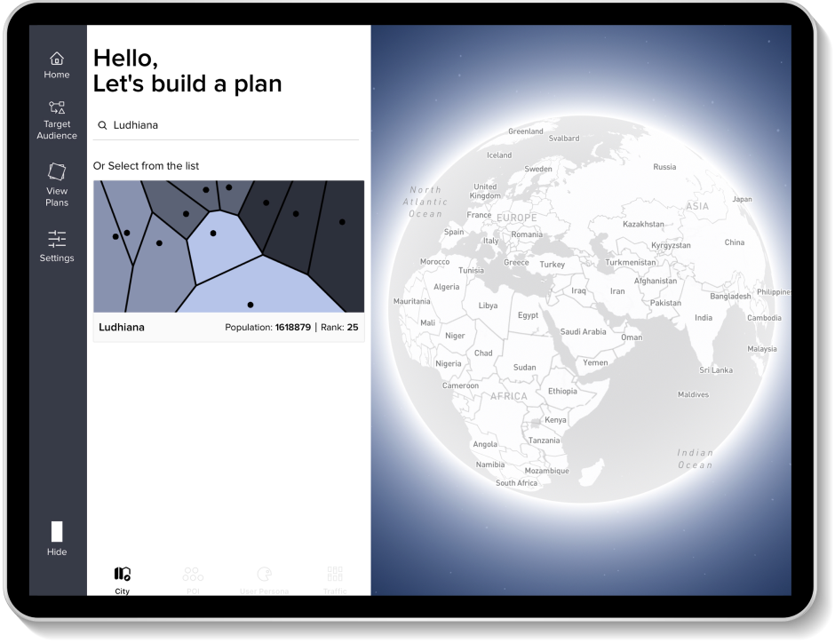
City Selection

Select the city of Ludhiana from the list to build a plan for Tyres.

You will be taken to the selected city.

City Selection
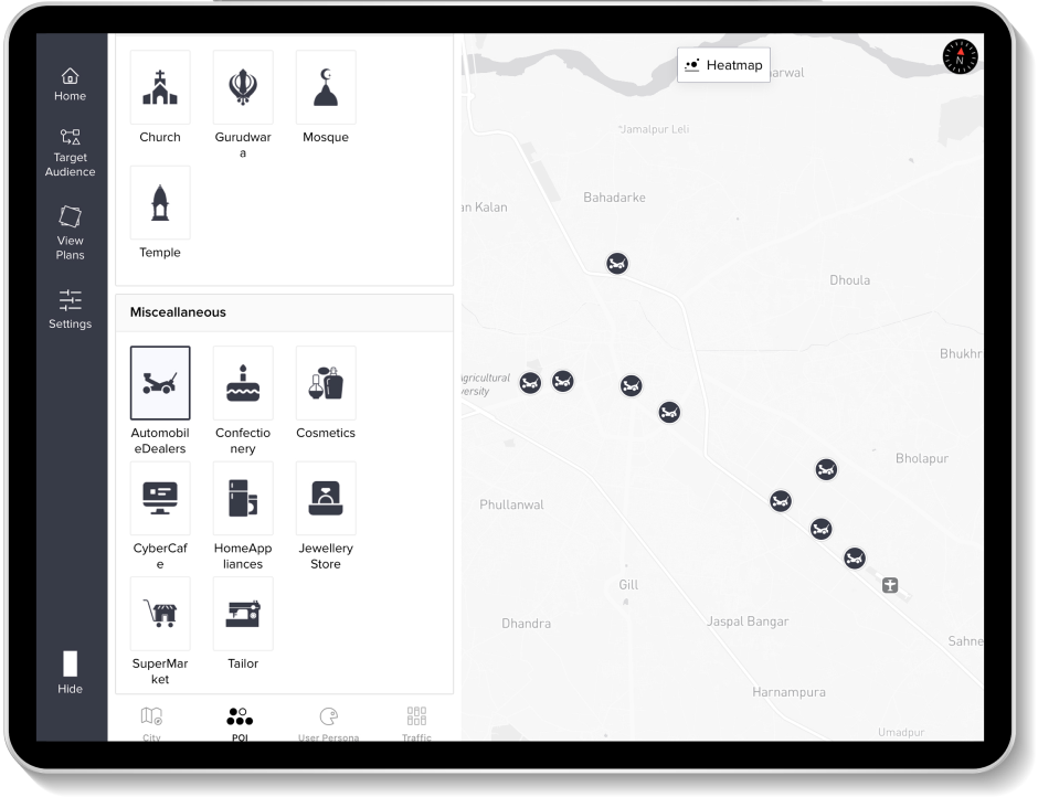
Analyze POIs

Analyze with relevant Points of Interest (POIs)

We have chosen Automobile Dealers.

Our rationale was to campaign where users are most likely to procure the product and decide to buy it.

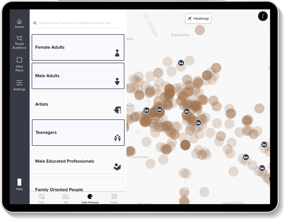
Add User Personas

For this plan, we will target: Adult Females, Adult Males, and Teenagers.

User Personas
Traffic Analysis
  • City

    Ludhiana

  • POI

    Automobile Dealers

  • User Persona

    Adult Females, Adult Males, Teenagers

Traffic Analysis

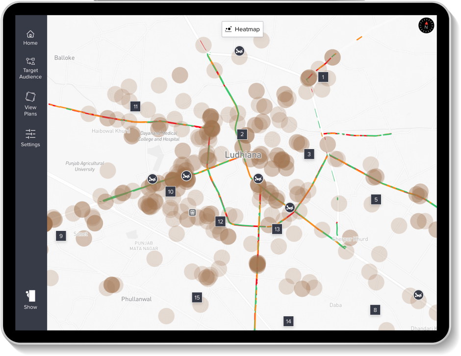
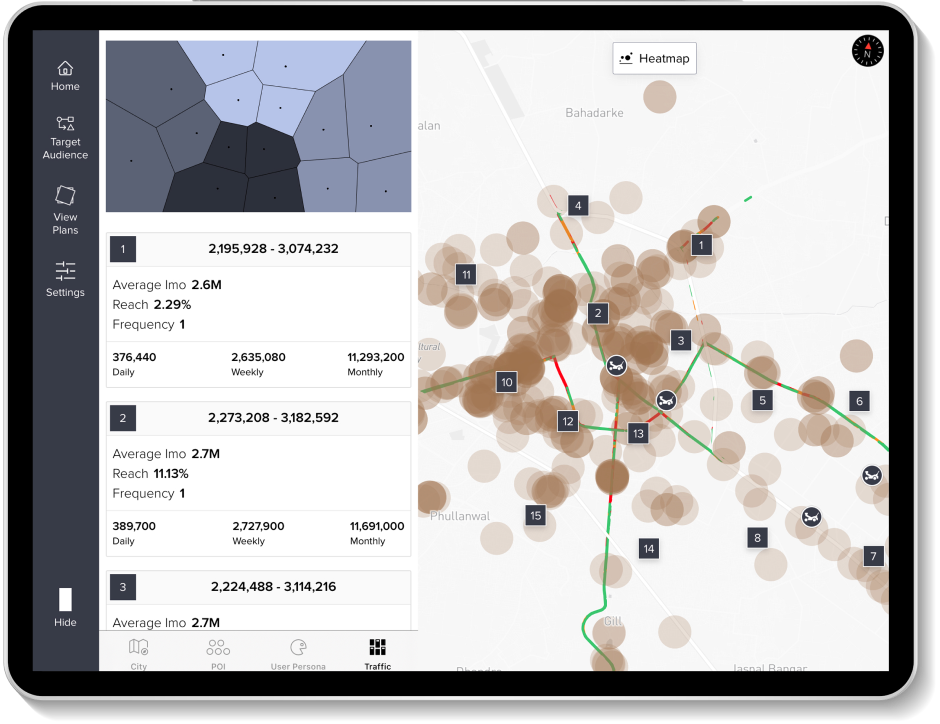
Validate the selected POIs and Personas with traffic data and identify high-traffic areas to pinpoint possible campaign locations.

Traffic Metrics

You may further assess each location using traffic metrics, with monthly/weekly/daily impressions, reach, and frequency.

Traffic Metrics
Heatmaps

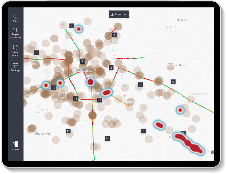
Heatmaps for Validation

We use heatmaps to pinpoint quality potential locations.

The darker red areas on the heatmap indicate a high density of traffic, coupled with the presence of our target audience and points of interest (POI), making them optimal locations for our campaigns.

The Final plan looks something like this, but with more possibilities, as you will be able to add Media, Prices, and consumption patterns for deeper insights and efficient allocation.

With Meridian Prime, you can do this for different cities, for different reasons, and for different brands. The possibilities are endless with further integration of Large Language Models, Machine Learning, and AI capabilities.

The Moshpit App

Moshpit is your last mile tool to manage your assets and fleet on the ground.

The app allows users to remotely monitor and manage physical assets, campaign activities, and the on-ground team in real-time with total accuracy.

With Moshpit, the on-ground team can reach remote areas with ease and accuracy. The app allows users to manage assets even in areas without an active internet connection. Yes, it works offline; accurately.

App Store Icon Google Play Icon

Let’s delve into the functionalities of the app:

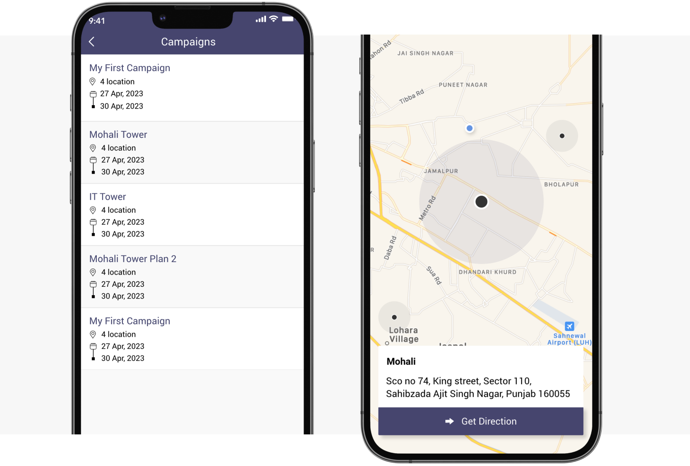
Assign Multiple Campaign Locations

You can assign multiple campaign locations to the on-ground team to verify the condition of your physical asset.

Users can reach the campaign location with 100% surety using the ‘Get Directions’ feature of the app.

Campaign Locations
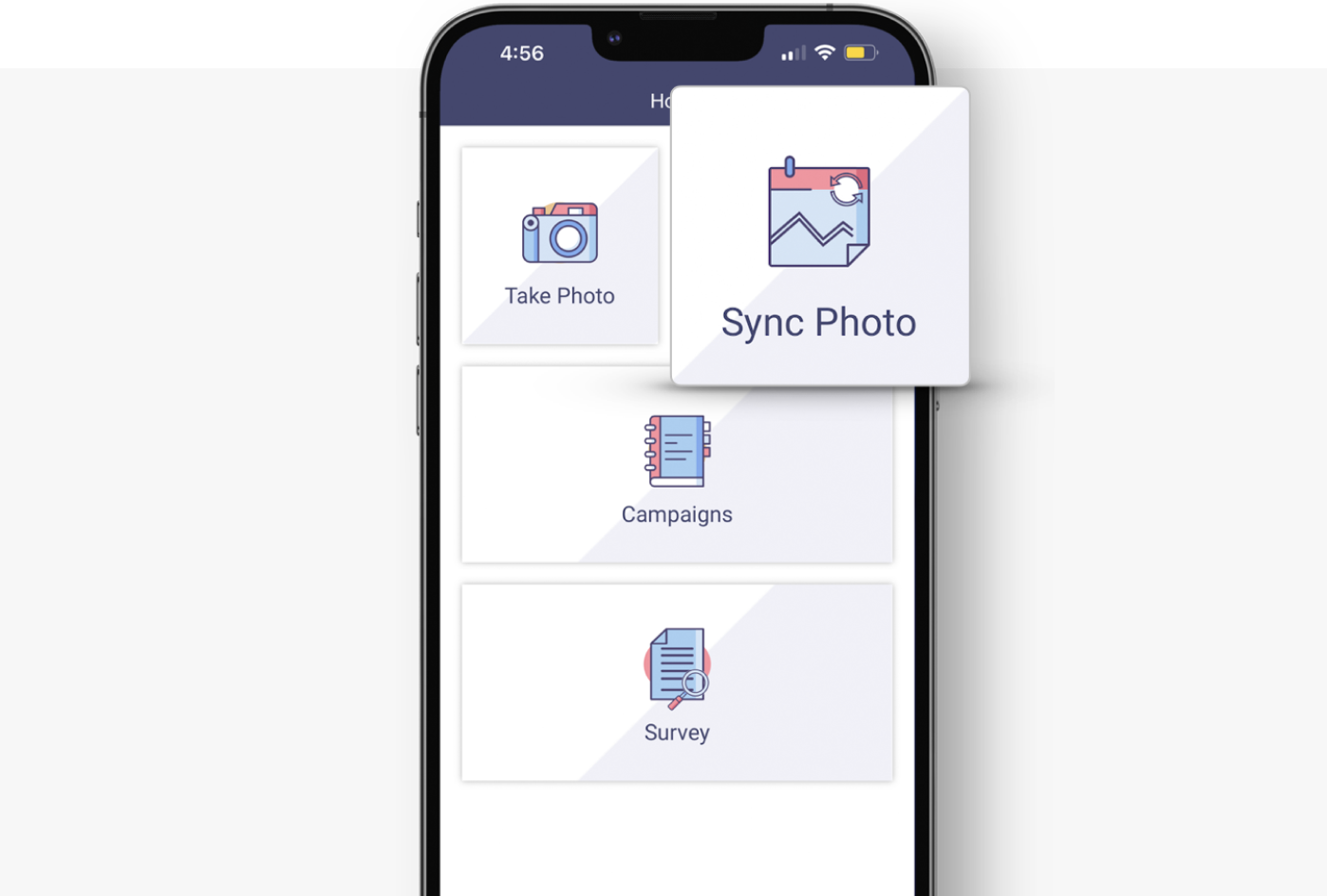
Take Photos

Take Photos

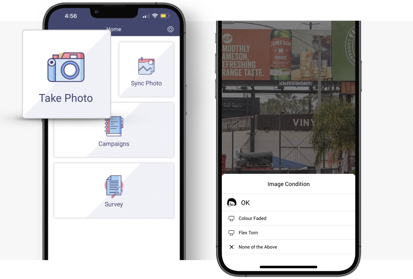
When the on-ground team reaches the campaign location, they can click pictures of the physical assets using the apps’ built-in camera.

The team can verify the condition of the physical asset when prompted to choose if the physical asset is ‘ok’ or ‘damaged’, or they can also add remarks if needed at the moment.

Take Photos in Remote Areas

Your team can click pictures even in remote areas with limited internet connectivity; these pictures are automatically stored in the sync folder and are instantly uploaded to the Dashboard when the device has access to a stable internet connection.

Remote Areas
Visual Reports

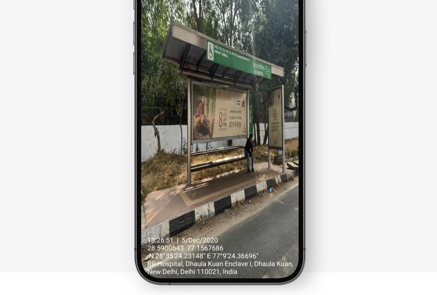
Collect Accurate Visual Reports

The pictures clicked by the on-ground team are embedded with real-time geotags for location verification. The images are stamped with precise location data, such as latitude and longitude coordinates, complete address of the location, date, and time when the picture was taken.

Take Survey at the Campaign Location

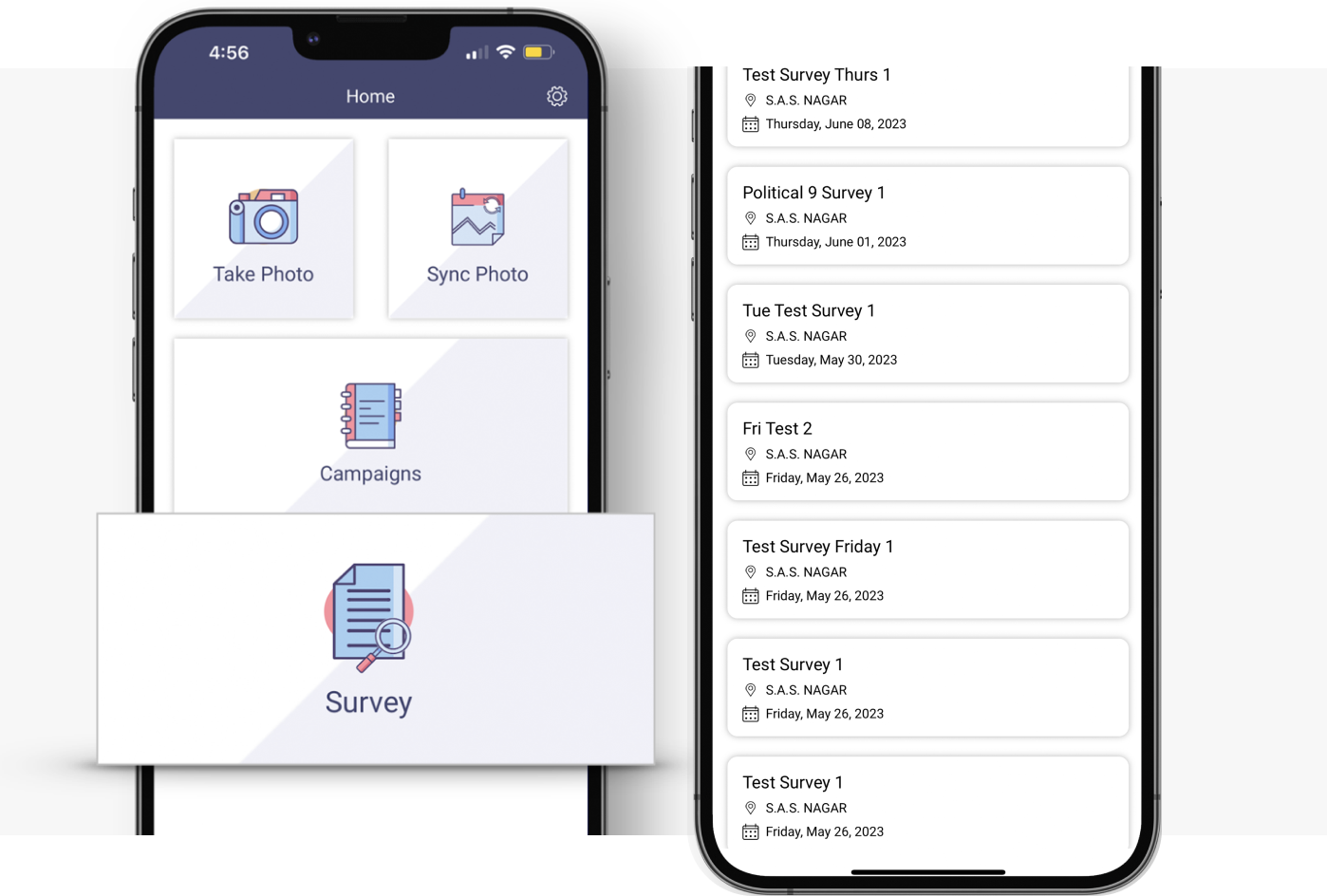
The team can ask questions to the nearby target customers, and you may tally the responses remotely through the Dashboard.

Everything reported by the on-ground team through the Moshpit app is accessible in real-time on the Dashboard.

City Selection

Brand Manager

Stay on top of everything with a 360° view of your campaigns. Take complete control of all the activities, campaigns, physical assets, and the team.

Designed for senior executives, the Brand Manager app lets users run a better campaign with precise location data that streamlines marketing operations, minimizes waste and pilferage, and helps achieve campaign objectives.

App Store Icon Google Play Icon

Let’s delve into the functionalities of the app:

Centralized Campaign Management

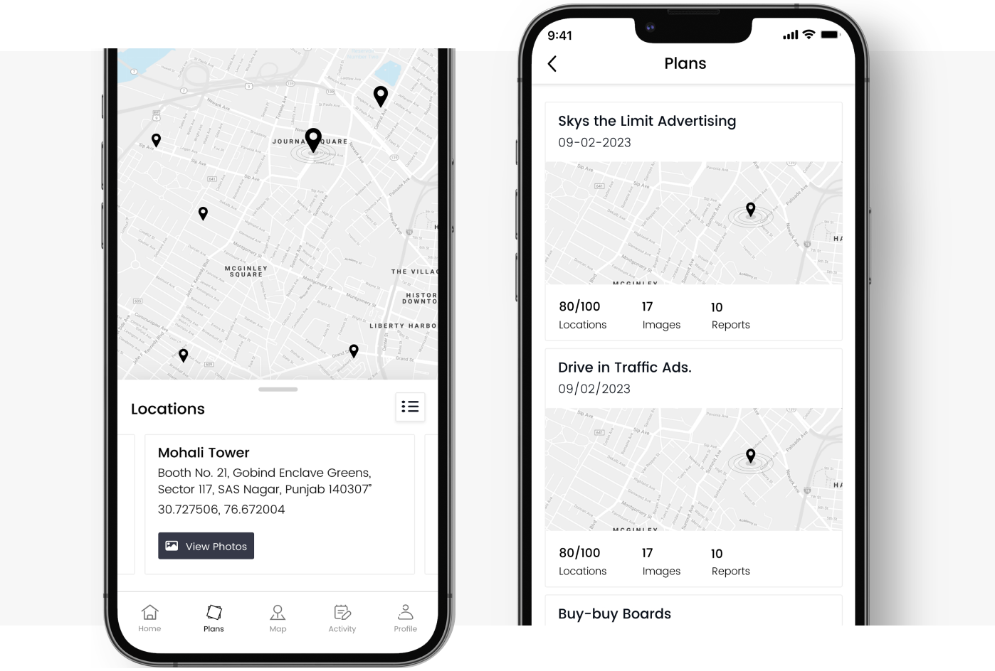
With Brand Manager, you can conveniently access multiple campaigns in one place and navigate effortlessly through the campaigns to access location-specific images and data.

Campaign Management
Check Location

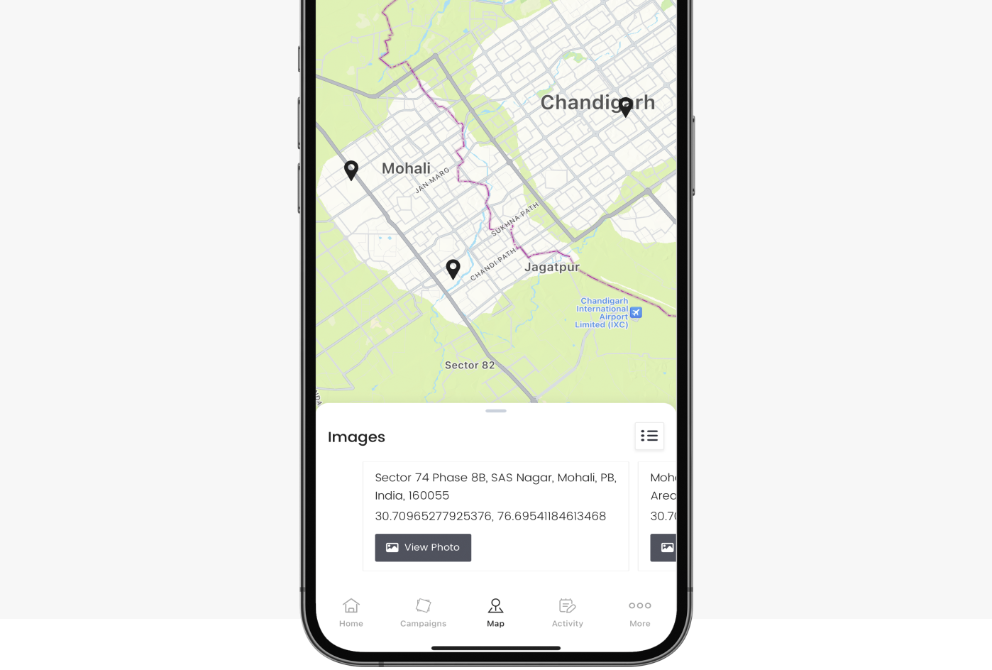
Check Every Location on the Map

You can oversee each campaign location on the map across the country, state, city, or zila parishad. Also, view the geotagged pictures associated with each location with their proper geographical point on the map.

Monitor each point of activation and campaign outreach with maps.

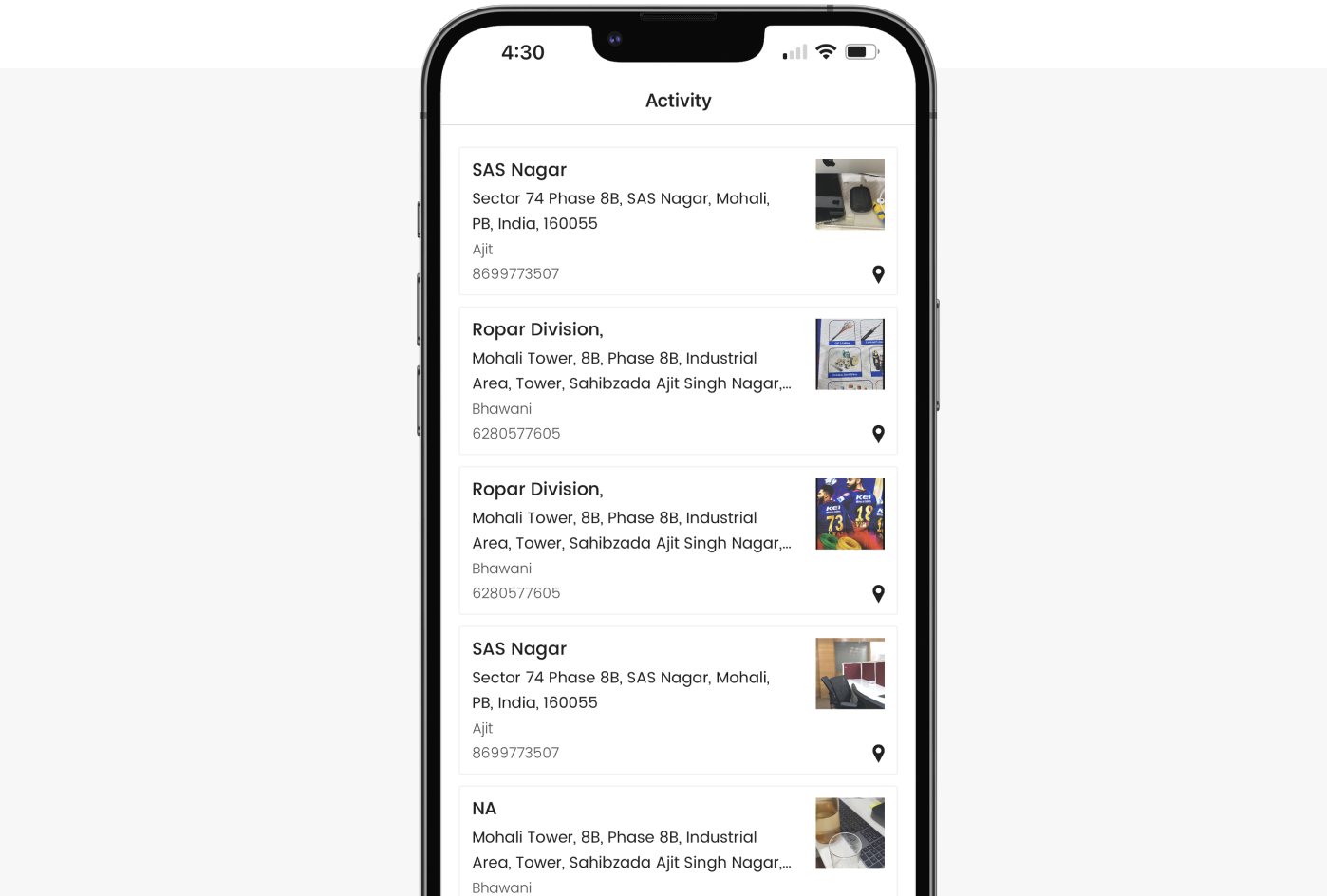
Monitor Campaign Activity in Real-Time

You can have a consolidated view of all the images taken by the on-ground team from each campaign. The geotagged pictures taken by the on-ground team are updated in real-time on the activity section of the app.

Monitor Campaign Activity

If You Can't Join Them, Beat Them!

The Meridian.API Newsletter

A newsletter about geospatial analytics, location intelligence, AI, data science, and data visualization. A newsletter also about building world class products and use of science, mathematics, and logical reasoning. A newsletter about sticking up to the man but also have fun doing business with him.

Personalized Services & Capacity Building

Build your own with our team of data scientists, statisticians, application developers and software engineers. Use geospatial data sets to augment sales, operations and gain deeper insights into your customer.

We actively work with our clients in setting up their own teams, digital ecosystem, and processes. We provide technical training, help with hiring and building in house data driven capabilities for the organizations we work with. You can leverage our expertise to build your own data-driven platform.

Kindly fill the form and we shall get back to you in flashiest of flashes.

If you’re eager to get in touch quickly, schedule a call with us.

Book an Appointmentchevron_right
|
+1
Obliged
Thank you for reaching out to us!

Your message has been successfully submitted. We will get back to you as soon as possible.

Something went wrong!

Please try submitting the form again. If the issue persists, please contact us directly at meridian@hashbrown.com.